
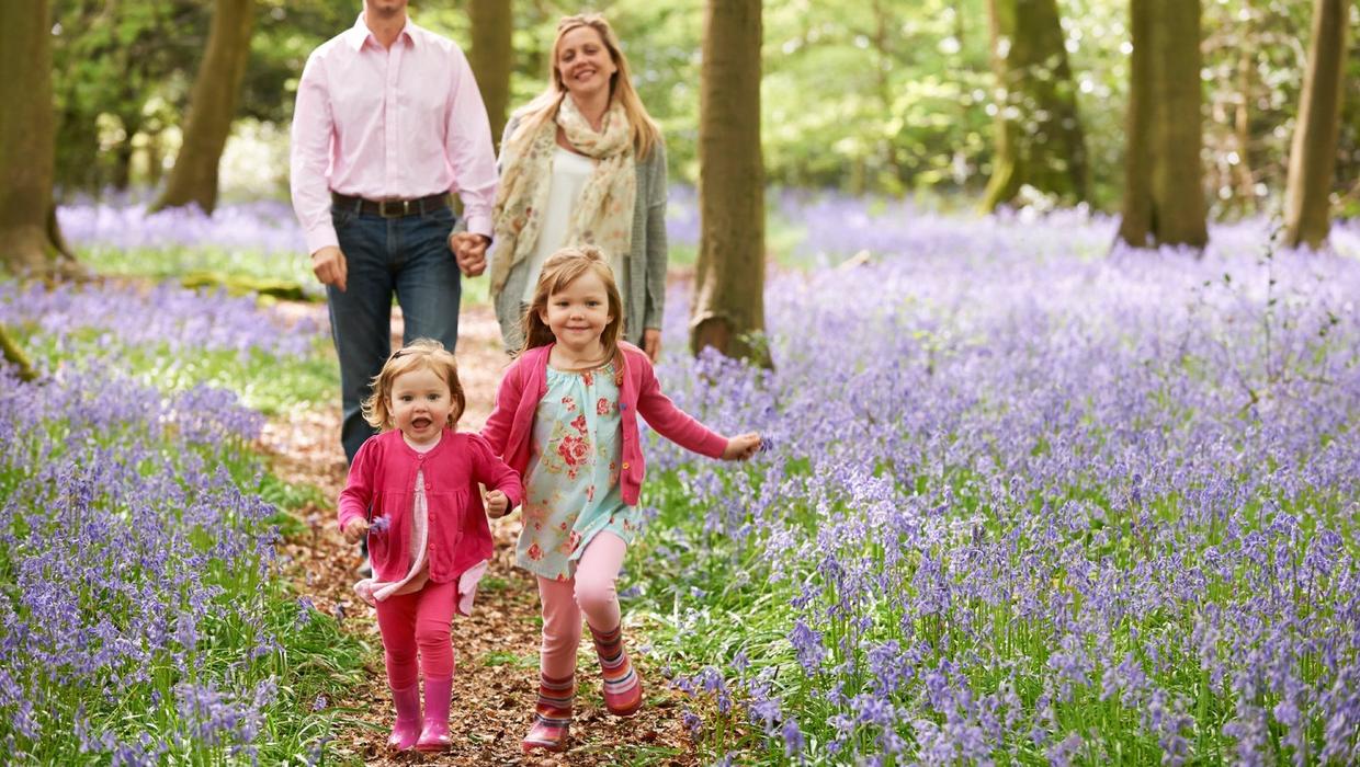
Now the country is in partial lockdown amid the coronavirus pandemic, walking is the new social outlet for many.
ith new social distancing guidelines in place, many events and social gatherings have been cancelled.
With that in mind, we’ve rounded up a selection of excellent hikes and trails, chosen by three expert walkers – authors all – which are particularly good in spring.
That means places with the finest bluebell displays, the best newly green woodlands, the most dramatic scenery. The result is 25 great routes across the country.
There are trails here for families with toddlers or buggies, for those looking for a good stretch, and for serious hikers wanting to blow the cobwebs out of their hair after the dark winter.
Each walk listed includes the distance and the time it takes to complete at a moderate pace, as well as directions to the start point.
Most of the routes can be covered without maps, but we have included references to where maps or guides can be found for trickier trails.
Of course, the usual rules apply – wear a pair of broken-in shoes or boots, waterproof gear if the weather is looking dodgy, pack a protein snack and water, charge your mobile phone, and always let someone know if you’re setting off on one of the more strenuous hikes.
And the new rules: try avoid popular spots if you’re worried about crowds and want to keep your distance.
Here’s part one today and don’t forget part two tomorrow.
DUBLIN
1. Best blue way
Where: The Royal Canal Way, Castleknock, Dublin 15 to Leixlip, Co Kildare
What: With your back to Castleknock railway station, turn left and join the canal towpath. Soon you reach the Deep Sinking, a narrow limestone cut where the path rises 10 metres above the water. Back in the 19th century this section sometimes proved fatal for draught horses towing barges through the chasm below. The path is rough underfoot here, but a smooth, newly resurfaced trail takes over from Clonsilla onwards. The landscape grows more rural now, with fields bordering the path. Five bridges mark your progress towards Leixlip, where the Ryewater Aquaduct carries the canal over the river Rye. This took six years to build in the 1790s. Around 500 metres later, cross a road bridge to reach Leixlip’s Louisa Bridge railway station.
Start/Finish Start: At Castleknock railway station and finish at Leixlip’s Louisa Bridge station.
Getting there: This is a linear walk, but frequent trains take just 13 minutes to run between the two stations.
Level: Easy to moderate – flat towpath, largely surfaced makes this a good route with small children.
Length/Time: 10km / 3 hours.
2. Best for high forest trails (and buggies)
Where: Cruagh Wood, Dublin Mountains
What: This route is accessible to everybody, including children in buggies, but still reaches 450 metres high and offers fabulous views over Dublin city. There are several signed walks here, but the best circuit is the Sli na Slainte trail. This makes a relatively straightforward loop from the car park, following forest tracks and surfaced paths throughout. The trail is surrounded by pine trees and includes a gentle climb and descent of 100 metres. Where the trees allow, fabulous views extend over the Dublin Mountains, the city and the east coast.
Start/Finish: At Cruagh Wood car park.
Getting there: Exit the M50 at junction 12, then navigate south to the R115 Old Military Road. Turn left off this on to Cruagh Road, signed to Glencullen. The forest entrance is 1km later on the right. It closes at 5pm.
Level: Easy to moderate – signed, surfaced woodland trails with 100m ascent.
Length /Time: 5km / 2 hours.
Pack: A natural treasure-hunt list to encourage kids to investigate the forest
.
3. Best for city views
Where: Fairy Castle Loop, Dublin Mountains, Dublin 18
What: It should be mandatory for every Dubliner to visit 536-metre Fairy Castle to gain a whole new perspective over the metropolis below. The route to the top is straightforward, with constructed paths and frequent signs to aid navigation. An initial road climb brings you to the massive communication masts on Three Rock Mountain. Now turn right alongside a forest, and climb across open mountainside to the summit of Two Rock Mountain, crowned by the massive megalithic tomb known as Fairy Castle. The incredible panorama extends from the Wicklow Mountains in the south to the Mourne Mountains in the north. Descend along the ridge, then follow signed paths and tracks back to the start.
Start/Finish: At Ticknock Forest trailhead.
Getting there: From Ticknock Forest entrance, drive uphill, looking for a track on the right with adjacent map board. Park in the nearby lay-bys.
Level: Moderate to difficult – signed paths with 230m ascent.
Length / Time: 6km/2.5 hours.
Pack: Helen Fairbairn’s ‘Dublin & Wicklow: A Walking Guide’; and a flask of tea to celebrate your arrival.
4. Best for coastal views
Where: Bray Head Loop, Bray, Co Wicklow
What: Join the Bray-Greystones coastal path at the eastern end of the car park, and turn right. Just 20 metres later, turn right again up a set of concrete steps. Climb straight ahead, through a patch of woodland, to a large concrete cross at 197 metres. There are wonderful views here across Killiney Bay to Howth. Continue south now, closing the gates behind you, to follow a path that climbs to a trig pillar at 240 metres. Shortly before the pillar, turn left on to a path that descends south-east through a gate across rock and grass. Turn left to join the paved coastal path, and left for 2km to return to the car park.
Start/Finish: At Bray Head car park.
Getting there: The car park lies at the end of Raheen Park, in south-east Bray. Alternatively, start and finish at Bray railway station, walking south along the promenade to reach the car park.
Level: Moderate to difficult – unsigned mountain trails and constructed coastal path, with 295m ascent.
Length /Time: 7km / 2.5 hours.
Pack: Your camera – this is an immensely scenic circuit.
LEINSTER
5. Best mountain crash site
Where: Annaloughan Forest, Co Louth
What: This popular circuit is fully signed. It explores the lower slopes of Annaloughan Mountain and the trees of Rockmarshall Forest. The forest is a mixture of deciduous and pine trees, with patches of bluebells and wood anemone in spring. Open sections also offer fabulous views over Dundalk Bay and Slieve Foye. Begin by following the purple arrows east along the road, then turn left onto a lane. This leads to a series of tracks and paths that loop around the hillside. Once out on open mountain terrain, a short detour brings you to the site of a 1942 plane crash, where metal wreckage still lies on the ground.
Start/Finish: At Fitzpatrick’s Bar and Restaurant, Rockmarshall, Dundalk.
Getting there: Exit the M1 at junction 18, then follow the R173 towards Carlingford. You’ll reach Fitzpatrick’s Bar after 7km.
Level: Moderate – signed tracks and paths with 230m ascent.
Length /Time: 8.5km/3 hours.
Pack: A copy of Adrian Hendroff’s book, ‘The Mourne and Cooley Mountains: A Walking Guide’.
6. Best for beachcombers
Where: Clogherhead Coastal Walk, Co Louth
What: This circuit may be short, but it explores a fascinating section of coastline, with views stretching from the Mourne Mountains to Lambay Island. From the beach car park, head back along the road for 100 metres. Turn right at a junction, then left along a lane. At the next T-junction, turn right and continue for 1km to the large harbour of Port Oriel at the end of the road. Turn right here and follow a series of low cliffs around the headland and back to the beach. Archaeologists believe these coastal outcrops provided several rock slabs used in the construction of Newgrange and other tombs in nearby Boyne Valley. If you want more distance, continue as far as you like along the beach itself.
Start /Finish: At Clogherhead Beach car park.
Getting there: From Drogheda, follow the R166 north-east to Clogherhead village. In the village centre, follow signs for the Lifeboat Station.
Level: Easy to moderate – unsigned tarmac lanes and coastal paths.
Length /Time: 3km / 1.5 hours.
7. Best for spring flowers
Where: Killinthomas Woods, Co Kildare
What: This beautiful deciduous woodland features one of the country’s best carpets of bluebell and wild garlic during the month of May. Primrose and celandine also find shelter beneath the lime-green leaves of the mature beech trees, and it’s impossible to come here in spring without leaving uplifted and refreshed. Choose from 10km of signed walking routes, all of which start and finish at the car park. There are options for both long and short outings, with the ‘Camp Walk’ and ‘Bluebell Walk’ both accessible to wheelchairs and buggies.
Start/Finish: At Killinthomas Woods car park.
Getting there: From the centre of Rathangan town, take the R401 towards Edenderry. Turn right at a roundabout onto the L3001, then look for a right turn signed to the ‘Woods’.
Level: Easy to moderate – largely flat, signed woodland paths.
Length /Time: Up to 10km / 3 hours
Pack: A wildflower book for identifying the species you see.
8. Best for history buffs
Where: Moore Abbey, Co Kildare
What: When a woodland has a walking trail called the Bluebell Way, you can guarantee it’ll be pretty in spring. This particular trail follows a cypress-lined avenue, and radiates colour when the bluebells are in flower. This is one of three short, signed routes in the forest beside Moore Abbey; complete each walk separately, or mix-and-match them to make a longer outing. The trees are a mixture of conifer and broadleaf species, while the abbey occupies the site of a former monastery, first founded by St Evin in the 5th century. The current building dates from the 1760s.
Start/ Finish: At Moore Abbey forest car park.
Getting there: Exit the M7 at junction 14, then follow the R445 towards Monasterevin. Take the first left onto the R427 towards Athy; the forest is on the right, 1km later.
Level: Easy – flat and signed woodland trails.
Length /Time: Up to 4km / 1.5 hours.
Pack: A camera to capture the beauty of the flowers.
9. Best for playing at High King of Ireland
Where: The Ridge of Cappard, Co Laois
What: Beautiful Glenbarrow is the most popular of the Slieve Bloom glens. This route explores the base of this glacial valley, then climbs onto the enclosing mountainside to the Ridge of Cappard. There are five marked walks here, and this route is an amalgamation of many of them. Begin by following an atmospheric woodland path along the nascent River Barrow. Pass the famous triple tiers of the Clamphole Waterfall, and continue upstream to an old water mill. Now turn left and climb out of the trees, joining an elevated boardwalk on top of the ridge. Far-ranging views encompass all four provinces of Ireland. Follow walking arrows back to the start via more boardwalk and forest tracks.
Start/Finish: At Glenbarrow car park.
Getting there: Head to the village of Rosenallis, along the R422. Turn south opposite the church, and follow brown signposts to Glenbarrow car park.
Level: Moderate – signed trails with 180m ascent.
Length /Time: 10km / 3 hours.
Pack: ‘The Comeragh, Galtee, Knockmealdown and Slieve Bloom Mountains: A Walking Guide’, by John G O’Dwyer.
10. Best for hikers
What: Scarr and Kanturk Mountains, Co Wicklow
Where: This memorable route traverses a pair of mid-height peaks, providing fine views over the Wicklow Mountains. Begin by heading northwest along the road. After 1.5km you pass a bridge; 60 metres later, turn right through a wooden gate onto a footpath. Pass above Lough Dan, then cross a track. The path climbs a mountain shoulder to a maze of granite outcrops at the summit of Kanturk (523 metres). Continue south-east across a col to reach 641-metre Scarr, with its narrow summit ridge and fabulous views. To descend, head south to a forest track, then turn left onto a road that carries you back to Oldbridge.
Start/Finish: At a lay-by in Oldbridge.
Getting there: From the hamlet of Oldbridge, turn north, following signs to Lough Dan. Park 250m later in a large lay-by on the left.
Level: Difficult – unsigned mountain paths and 540m ascent.
Length/Time: 14km/4.5 hours.
Pack: Detailed route notes from Helen Fairbairn’s ‘Dublin & Wicklow: A Walking Guide’.
11. Best for a taste of monastic life
Where: Derrybawn Woodland Trail, Glendalough, Co Wicklow
What: This circuit explores Glendalough’s prized oak woods, and is particularly beautiful in spring when bluebells and other wildflowers are in bloom. The walk is signed throughout by orange arrows. From the south-west corner of the car park, cross a footbridge and turn right onto the wide trail known as the Green Road. After 200 metres, another footbridge offers access to the 6th century monastic city, which is well worth a detour. Then continue along the Green Road to the park information office. Turn left here, climbing a series of steep steps beside Pollanass Waterfall. Follow a high forest road across the slopes of Derrybawn Mountain, before dropping back to the Green Road and returning through mature oak trees to the start.
Start/Finish: At Wicklow National Park Visitor Centre car park.
Getting there: The visitor centre is located roughly 3km west of Laragh village, along the R757.
Level: Moderate – signed woodland trail with 160m ascent.
Length /Time: 8km/2.5 hours.
Pack: ‘The Walking Trails of Glendalough’ leaflet, available from the visitor centre or wicklowmountainsnationalpark.ie
12. Best for tree lovers
Where: Clogrennan Wood, Co Carlow
What: This woodland is relatively old by Irish standards, with forest cover stretching back to the 1800s. Today it is home to various tree species, including beech, spruce, larch and oak, with spring flowers including bluebells, wild garlic and herb robert. A signed loop walk begins from the car park and explores a series of forest tracks. It’s short enough to appeal to families, and a section of open, hillside path allows long views across the Carlow countryside to the Wicklow and Blackstairs Mountains. Follow the purple arrows throughout to stick to the main path, or divert off onto a host of meandering side trails.
Start/Finish: At Clogrennan Wood car park.
Getting there: Exit the M9 at junction 6, then follow Google map directions to Clogrennane Lime Ltd. The forest car park is 400m west of the lime works.
Level: Easy – flat, signed woodland tracks.
Length /Time: 4km / 1.5 hours.
Pack: A phone loaded with Google maps to find the start.
13. Best for waterside walkers
Where: The Barrow Towpath, Graiguenamanagh to St Mullins, Co Carlow
What: This out-and-back route follows a tranquil towpath along the banks of a verdant waterway, pausing for lunch in the pretty and historic hamlet of St Mullins. The walk forms the final section of the 114km-long Barrow Way, but you join the route on the eastern side of Graiguenamanagh’s seven-arch bridge. From here, head downstream along a lane that soon turns into a footpath. Navigation is straightforward; simply follow the river bank all the way to St Mullins. Along the way you encounter four locks, and pass through deciduous woodland and a steep-sided valley. In St Mullins, the riverside buildings were once a water-powered mill. Then detour 400 metres up the road to visit an atmospheric old monastery and adjacent Norman motte, before returning to Graiguenamanagh.
Start/Finish: At Graiguenamanagh.
Getting there: Graiguenamanagh is located along the R703, 23km south-east of Kilkenny.
Level: Easy to moderate – flat riverside path.
Length /Time: 12km / 4 hours.